Saturday, May 31, 2014
Current time: 1:00am MDT (Sunday)
Log:
Location –
Chadron, Nebraska
14z (8am MDT)
Forecast discussion,,, Today’s storms are expected to be given enough lift from
the hilly terrain (orographic lifting) as opposed to lifting from a boundary
like we saw in Nebraska yesterday. Today’s conditions are more favorable than
yesterdays, but not as favorable as conditions tomorrow. Montana is more
favorable than Wyoming, but in order to be in Southern Nebraska or Kansas
tomorrow where conditions are more favorable than in Montana today, we have to
settle for second best in Eastern Wyoming to see even better things tomorrow.
14:30z (8:30am MDT) Head west on I-20.


15:27z (9:27am MDT) Cross border into Wyoming.
15:50z (11:50am
MDT)- We enter Lusk, Wyoming for lunch and waiting out the storm. Skies are sunny. Elevation is over 5,000
feet.


21:23z (3:23pm MDT) We decide to leave the park in Lusk. The weather is sunny and comfortable (mid 70s) in Lusk, WY, but there are some towering clouds in the distance and some nice cells so we decide to leave the park and move west on I – 18 to catch up with some cells firing up southwest of Chugwater, WY.
21:26z (3:26pm
MDT) – There is a storm with a VIL indicating a strong updraft and some
possible rotation on the velocity.


21:30z (3:30pm
MDT) – We make a turn south on WY – 270

22:36z (4:36pm
MDT) Storm west of Slater and Chugwater shows a couplet on radar (looking at
base velocity). Spin is cyclonic. The storm looks to be becoming a meso-cyclone
so there is the possibility of a tornado within that. Storm is showing a hook
on Base reflectivity as well. We are located near Guernsey, CO heading east on
I-26

22:43z (4:43pm
MDT) We are just outside of Guernsey and the storm we are heading towards west
of Slater and Chugwater still has an impressive couplet. The goal is to be on
the south side of that storm so we could get a good viewing of the couplet and
remain a safe distance.

22:45z (4:45pm
MDT) we turn east onto 26 in Guernsey
22:53z (4:53pm
MDT) Tornado warning issued for our cell. A government official has spotted a
funnel cloud! We are to the northwest of the storm near Fort Laramie heading southeast
on I-26.


23:07z (5:07pm
MDT) We continue east on I-26 in Lingle, WY
23:18z (5:18pm
MDT) We wait out the storm in Torrington, WY. There was no hail where we were,
just a bit of rain and plenty of lightening. After stopping for a bit and
deciding this cell would not be worth chasing further since it was weakening,
we continue Northwest on I-26 towards Scottsbluff, Nebraska for dinner.


1:30z (7:30pm MDT)
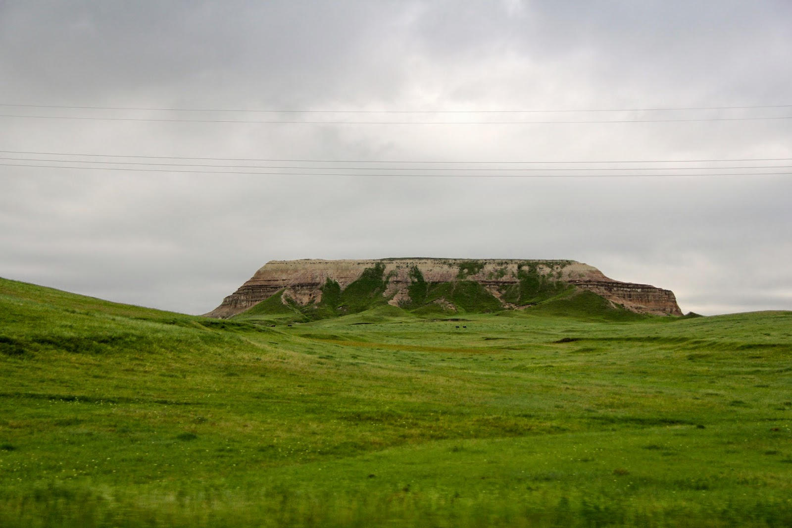
We arrive in Scottsbluff, NE for dinner eating Sonics/ Jimmy Johns outdoors and
enjoying the nicer weather and the beautiful bluff in the background.

1:50z (7:50pm MDT)
Pea sized hail at Sonic while still sunny due to the low sun angle from the
setting sun. The storm popped up by surprise likely getting shear from the
outflow of the other storm (which the other storm lacked) and used the
instability that was still available to its advantage.


2:10z (8:10pm MDT)
We have traveled a safe distance away from the storm giving us a perfect
vantage point to see the full structure of the storm. We find a part of a
double rainbow, beautiful cumulonimbus clouds who’s tops are illuminated by a
setting sun, and the most exciting part was a rotating wall cloud right in
front of us!


Approx 2:30z
(8:30pm MDT) – We leave Scottsbluff and head to our hotel for the night.
4:14z (10:14PM
MDT) We arrive at the Comfort Inn in Sidney, Nebraska for the night.
Journal:
Today was the
second day for chasing and the most exciting so far. The town of Lusk, Wyoming
was beautiful and the people very nice (good luck finding people in a park
asking to play basketball and then giving 14 people free water in NYC or NJ!).
The altitude got all of us very quickly out of breath however and the sun was
very strong so these were both issues that I had not thought of prior to actually
experiencing them first hand.
The environment in
Eastern Wyoming today was expected with the more favorable shear and CAPE
values, but the beauty and huge size of these storms we saw were something I
could not anticipate because they are so much more impressive than the storms I
am used to. The electricity in the storm was incredible. Our antenna became
charged at one point during the storm and we actually saw the electricity from
the charged antenna bending towards the weather radio in the car so that was an
unexpected and fascinating issue. This storm clearly meant business and was
much stronger than the storms in Nebraska yesterday. I learned a lot about
locating updrafts and downdrafts and inflow clouds and outflow clouds from this
storm in a real life scenario. It was a classic thunderstorm with a lot to see
including our first notable mammathus clouds of the trip.
Once our initial
storm began to loose steam and loose its couplet entirely, we gave up for the
night and had dinner, which was where we met the most impressive storm of the
day. The ironic thing was we did not expect the second storm to even exist and
it gave us the best lightening show and our most convincing tornadic activity
so far this trip! Interestingly the first storm had a couplet and the second
one did not and we saw much more rotation with the second storm than the first.
I think the 2 main reasons for this was 1) placement issues since we did not
get to the first storm in time to see the couplet from a view not blocked by
rain, and 2) the fact that Scottsbluff as a geographic feature might block
radar or might be something that the radar is programmed to avoid which would
have removed a couplet reading from radar. The second reason may be a bit of a
stretch, but a very interesting and possible problem Joe brought up on the way
to our hotel.
No comments:
Post a Comment